
What is a Digital Elevation Model (DEM)?
A Digital Elevation Model (DEM) goes beyond just being a dataset; it’s a dynamic three-dimensional representation of terrain, meticulously gridded with each cell containing a single attribute – typically an elevation value.
Unlike other terrain models, DEMs selectively filter out vector features such as streams, breadlines, ridges, and man-made structures, along with natural elements like buildings, towers, and vegetation.
Essentially, DEM serves as the overarching term encompassing both Digital Surface Models (DSMs) and Digital Terrain Models (DTMs).
The distinction between bare-earth and surface objects becomes blurred in DEMs, especially with spatial resolutions often exceeding 20 meters.
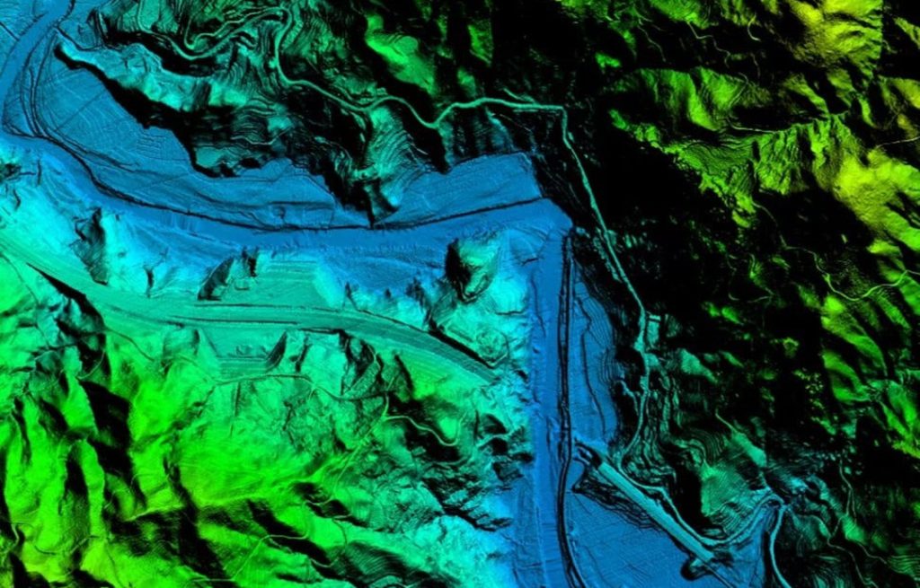
Yunnan Nonferrous Geological Bureau swiftly surveyed 950 sq. km of Yunnan Province's forests in 480 minutes using JOUAV CW-25E with JoLiDAR-LR22S. The DEM accurately captured the entire forestry environment. Read the full case study.
What Are the Uses of Digital Elevation Models?
The Digital Elevation Model (DEM) serves as a fundamental tool across various disciplines due to its multifaceted applications. The significance of DEMs spans critical domains such as land-use planning, infrastructural project management, soil science, hydrology, and flow-direction studies.
Modeling Water Flow and Mass Movements
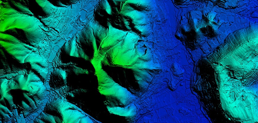
DEMs enable accurate modeling of water flow and mass movements, including the prediction and analysis of phenomena such as landslides. By incorporating elevation data, researchers and planners can simulate the pathways of water and potential mass movements, aiding in the development of effective mitigation strategies.
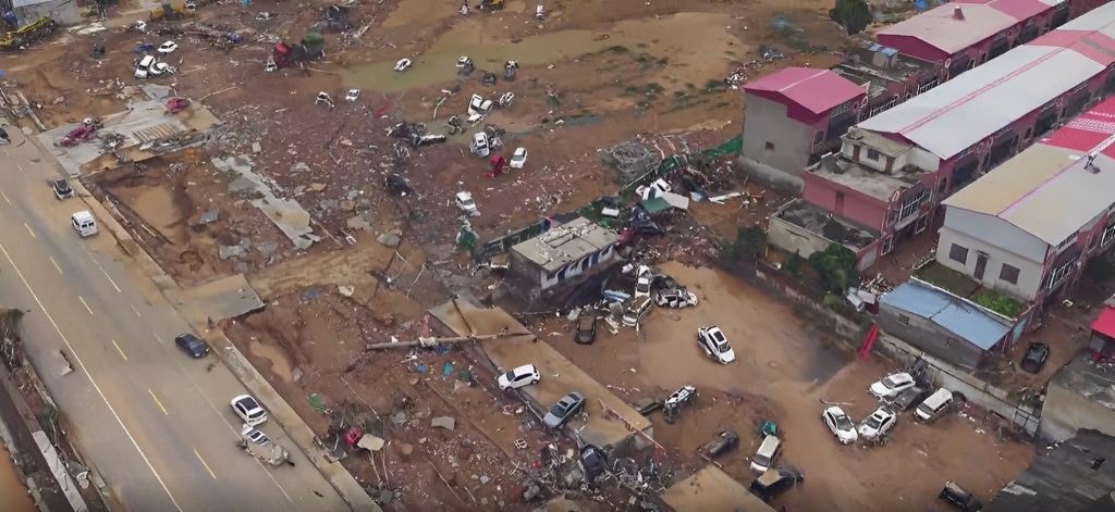
The oblique imagery of the Henan flood was captured by the CW-15 drone.
Creating Physical Models
The elevation data provided by DEMs facilitates the construction of physical models, such as raised-relief maps. These tangible representations are valuable tools for educational purposes, allowing individuals to visually comprehend the intricacies of the terrain and its features.
Rectifying Aerial Photography or Satellite Imagery
By integrating elevation information, these models correct distortions caused by varying terrain elevations, ensuring accurate georeferencing. This is particularly essential in applications where precise location data is imperative, such as in cartography and remote sensing.
Rendering 3D Visualizations
In geospatial technology, DEMs serve as the foundation for rendering three-dimensional visualizations. This capability is particularly advantageous for urban planning, environmental impact assessments, and virtual simulations, providing stakeholders with immersive and realistic representations of the terrain.
Reducing Gravity Measurements (Terrain Correction)
DEMs play a crucial role in the reduction of gravity measurements, particularly in fields like gravimetry and physical geodesy. Terrain correction, facilitated by DEMs, ensures that gravity anomalies are accurately interpreted by accounting for the influence of the underlying terrain, thereby refining the understanding of subsurface geological structures.
Analyzing Terrain in Physical Geography and Geomorphology
In physical geography and geomorphology, DEMs contribute significantly to terrain analysis. Researchers leverage elevation data to study landforms, analyze slope characteristics, and investigate the underlying processes shaping the Earth's surface. This information is invaluable for understanding landscape dynamics and formulating informed environmental management strategies.
What is a Digital Terrain Model (DTM)?
Digital Terrain Models (DTMs) are commonly regarded as synonymous with bare-earth DEMs, emphasizing their focus on representing the geodesic surface without considering persistent above-ground features such as vegetation, buildings, and artifacts.
The primary difference lies in the scope of information included in each model:
DEM vs. DTM
While DEMs consider all persistent ground features, such as vegetation and buildings, DTMs focus on the bare Earth's geodesic surface, excluding above-ground artifacts.
The essential disparity lies in the representation of terrain: DEMs include all objects, while DTMs prioritize the unadorned surface.
The term "bare-earth" in DEMs signifies the removal of surface features, ensuring that each cell denotes the elevation of the uncovered Earth surface.
In certain contexts, DTMs are perceived as vector datasets complementing DEMs, incorporating linear features like ridges and breaklines for an enhanced representation of bare-earth terrain.
DEMs depict Earth's surface features, incorporating both natural and artificial elements such as high-rise buildings.
In contrast, DTMs filter out man-made structures, providing a clearer representation of the unaltered ground surface.
In urban areas, DEMs may introduce inaccuracies due to building inclusion, whereas DTMs offer a more precise view of natural terrain, crucial for applications like flood modeling and infrastructure planning, especially in landscapes dominated by towering structures.
Regardless of the interpretation, a DTM is fundamentally a three-dimensional, digital representation of a surface, defined by X, Y, and Z coordinates.
This representation encapsulates not only elevations and heights but also natural features such as rivers and ridge lines.
The combination of these coordinates offers a comprehensive view of the Earth's topography.
How Are Digital Terrain Models Created?
The creation of a DTM involves the collection and processing of elevation and terrain shape data, with a focus on capturing surface discontinuities and special locations such as peaks, pits, ridges, and changes in slope.
The following methods are employed to gather the necessary data for DTM generation:
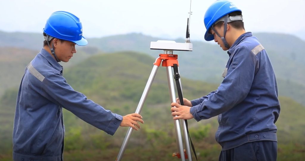
Ground Surveys
Ground surveys involve on-site measurements conducted by surveyors to capture accurate elevation data for specific areas.
This technique is renowned for its precision, especially in capturing details of surface discontinuities and unique topographic features.
However, ground surveys can be time-consuming and are typically applied to smaller study areas or specific projects.
The introduction of the Global Positioning System (GPS) has significantly enhanced the efficiency of ground surveys.
GPS relies on a constellation of satellites transmitting continuous time and position information, allowing users to determine their positions on Earth with remarkable accuracy, often within meters.
Photogrammetry Using Aerial Photographs
This technique extends the coverage beyond the limitations of ground surveys, making it suitable for larger study areas, even at a national scale.
Aerial photographs are captured and processed using photogrammetric methods to derive elevation data.
The accuracy of the resulting DTM depends on factors such as the quality of the aerial imagery, the calibration of the camera, and the processing techniques employed.
This method is efficient for capturing detailed terrain information over expansive regions.

PH-20 multi-rotor drone
Satellite images
Satellite imagery is another valuable source for DTM creation, offering a broader perspective that is particularly useful for large-scale mapping.
Similar to photogrammetry, the accuracy of DTMs derived from satellite images depends on the resolution and quality of the imagery.
Advanced satellite technologies, such as those equipped with high-resolution optical sensors and synthetic aperture radar (SAR), contribute to the precision of elevation data extraction.
These satellite-derived DTMs are instrumental in applications ranging from regional planning to environmental monitoring.
Digitizing or Scanning Existing Maps
Historical maps or topographic sheets can also be employed for DTM creation through digitization or scanning processes.
While this method may lack the real-time accuracy of ground surveys or contemporary satellite technologies, it remains a valuable resource for areas with limited data availability.
Digitization and scanning techniques, when coupled with modern geospatial software, allow for the extraction and interpolation of elevation data to construct comprehensive DTMs.