
What is LiDAR?
LiDAR, an acronym for "Light Detection and Ranging," stands as a revolutionary distance-measuring sensor, akin to its counterparts radar and sonar. Functioning by emitting laser pulses that rebound off objects, LiDAR sensors meticulously capture the intricate structure of their surroundings. The process involves recording the energy of the reflected light, enabling the precise determination of distances to objects. This, in turn, facilitates the creation of detailed 2D or 3D representations of the environment.
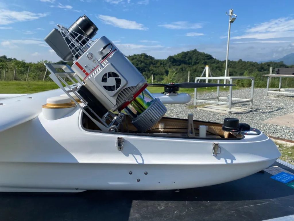
The JOUAV CW-25E VTOL drone with JoLiDAR-LR22S LiDAR sensor
LiDAR's superiority in sensing accuracy, compared to traditional technologies like radar and sonar, stems from its laser precision. It crafts detailed point clouds, essentially translating the features of objects or environments into tangible, solid representations on displays.
Operating across various wavelengths, from infrared (10 micrometers) to ultraviolet (250 nanometers), LiDAR employs different types of scattering (Rayleigh, Raman, Mie) tailored for specific applications. The ability to identify wavelength-dependent changes in the scattering signal extends its utility to the remote mapping of atmospheric composition and object properties.
The versatility of LiDAR extends across multiple platforms, from being mounted on aircraft such as airplanes, helicopters, or drones, to satellites, automobiles, and ground-based or hand-held devices. Remarkably, LiDAR has become so accessible that it's now found in everyday devices, including cell phones.
Topographic LiDAR
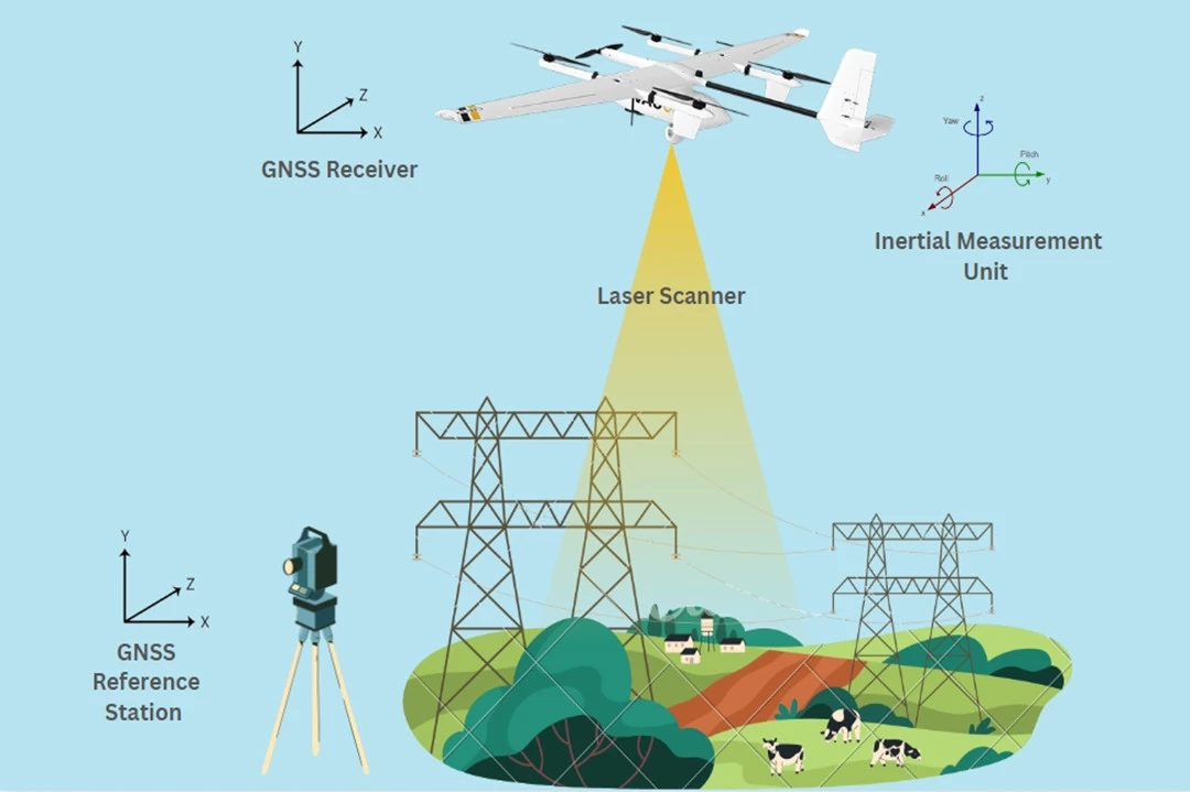
Topographic LiDAR, employing a 1,064 nm near-infrared laser, is extensively used for land-based mapping. This system captures a dense point cloud, enabling the creation of high-precision 3D maps and models of the Earth's surface. To enhance accuracy, UAV topographic LiDAR often integrates a GPS receiver and an inertial navigation system (INS). Post-processing of data further refines precision.
Bathymetric LiDAR
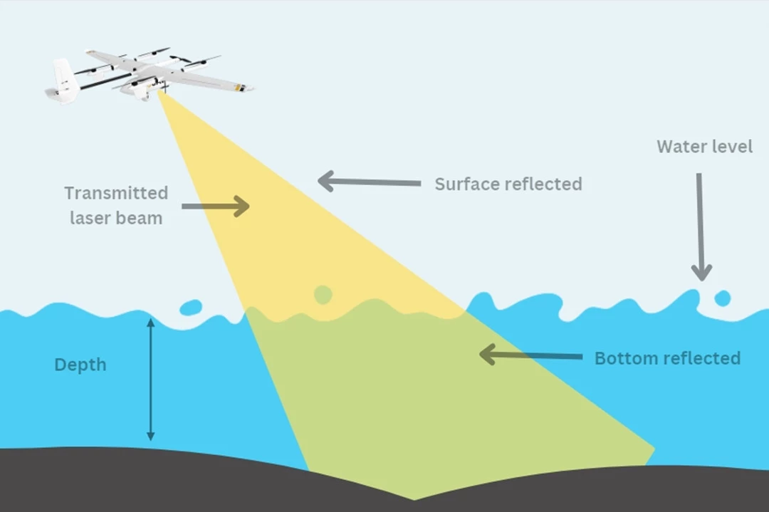
Bathymetric LiDAR systems, utilizing a green wavelength of 532nm, are specifically designed to measure seafloor depths and shoreline elevations. These systems provide valuable information near coastlines, harbors, and shores. The dual functionality involves collecting elevation and water depth simultaneously, utilizing both infrared and green lasers for comprehensive airborne surveys.
Mobile LiDAR
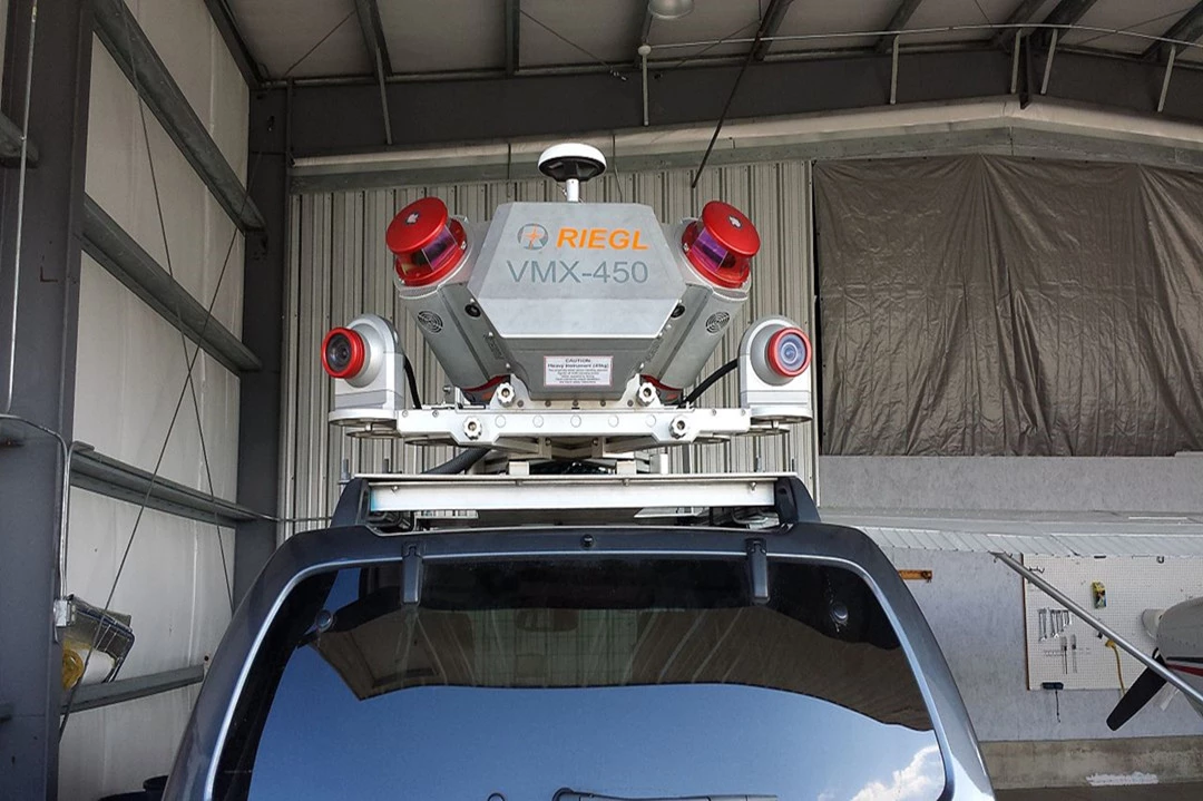
Dynamically mounted on moving platforms such as vehicles, trains, or boats, Mobile LiDAR systems play a crucial role in analyzing road infrastructure, identifying obstacles, and surveying transportation corridors. These systems often integrate LiDAR sensors with cameras, GPS, and inertial navigation systems for comprehensive data collection.
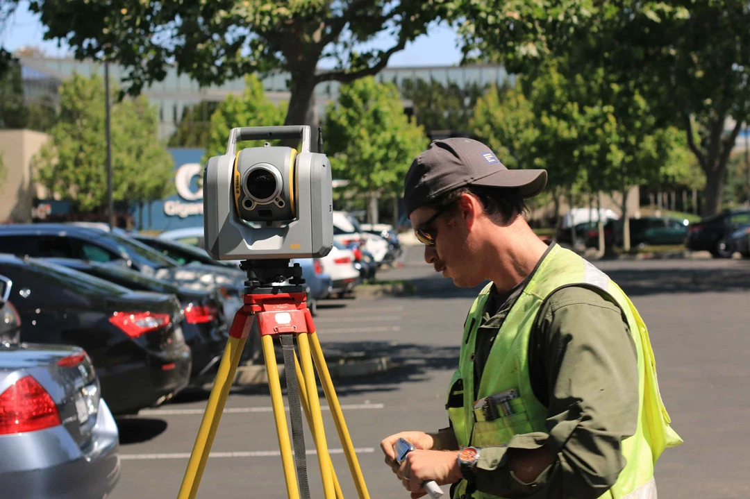
Static LiDAR
Positioned on tripods, Static LiDAR systems bring portability and flexibility to detailed scanning, accommodating both indoor and outdoor environments. Their applications span various industries, including engineering projects, mining operations, land surveying, and archaeological excavations.
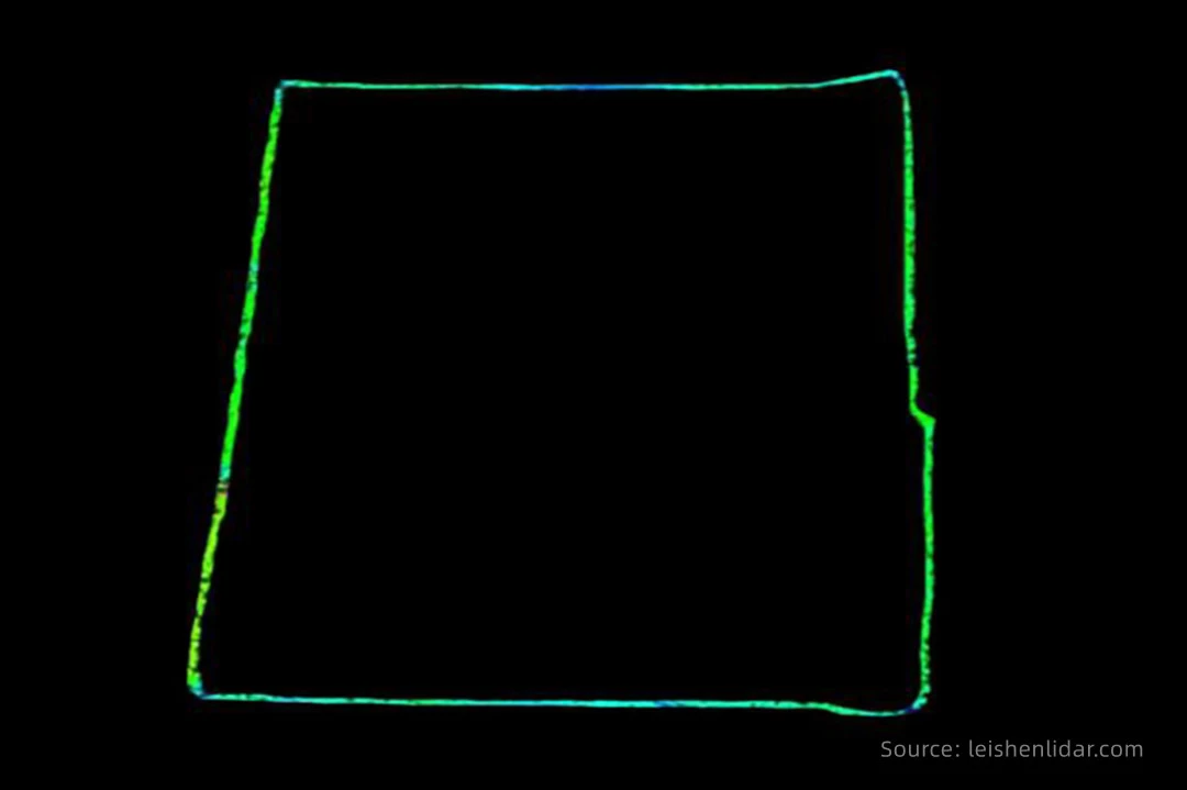
2D LiDAR
2D LiDAR operates by emitting laser pulses in a single plane, typically horizontal or vertical. The sensor gauges the time it takes for the laser pulses to return, offering distance information within that specific plane. This design comprises an emitter laser diode and a receiver photodiode, with each color representing a distinct "layer." For instance, a 64-layer LiDAR sends 64 lines of photons. This type of LiDAR finds utility in applications where a flat representation of the environment suffices, such as in industrial automation for basic obstacle detection, inventory management, and fundamental mapping tasks.
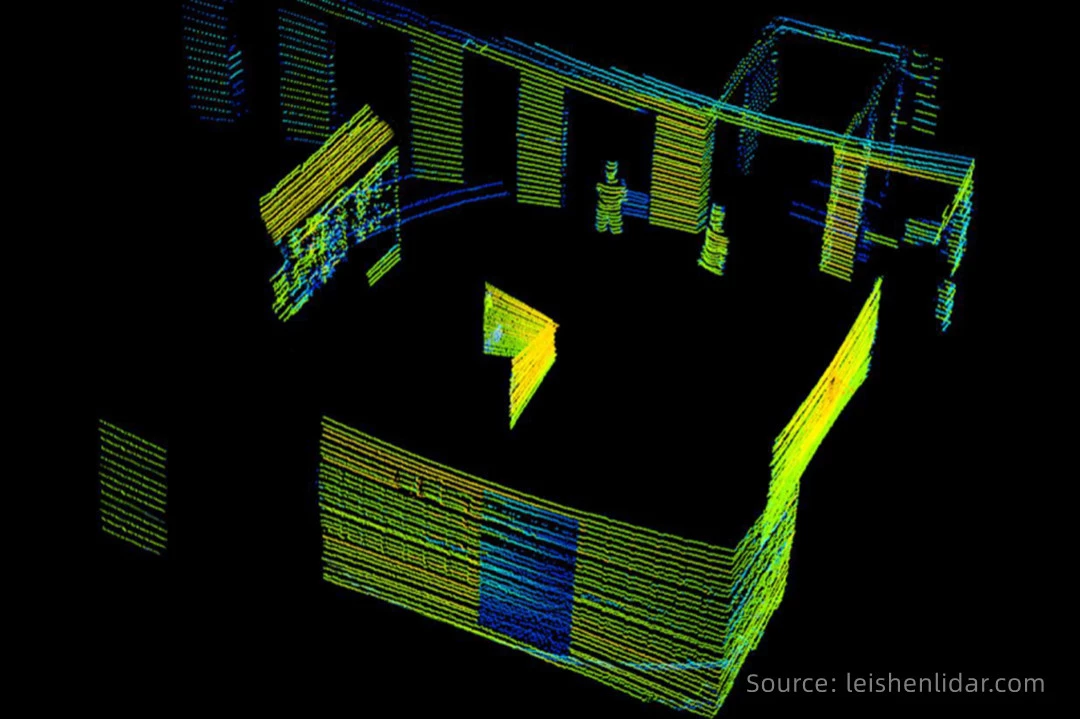
3D LiDAR
3D LiDAR captures spatial information in multiple planes (X, Y, Z), generating a detailed three-dimensional point cloud. This is achieved either by employing multiple lasers or a scanning mechanism that steers the laser beam in both horizontal and vertical directions. Ideal for applications demanding a thorough understanding of the three-dimensional structure of the environment, 3D LiDAR is commonly used in autonomous vehicles for obstacle avoidance, mapping, navigation, as well as in urban planning, forestry, and archaeology.
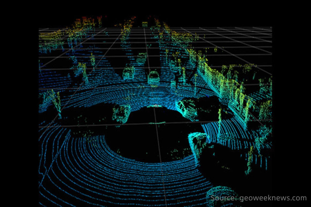
4D LiDAR
4D LiDAR goes beyond the static nature of 3D LiDAR by adding the dimension of time. This enhancement enables the sensor to capture changes and movements in the environment over time. Suited for dynamic environments where tracking moving objects or monitoring changes is crucial, 4D LiDAR finds applications in traffic management, security surveillance, and monitoring the flow of crowds in public spaces. It enhances situational awareness by not only providing a detailed 3D map but also allowing for the tracking of changes over time. This capability enables predictive analysis and monitoring of temporal dynamics.
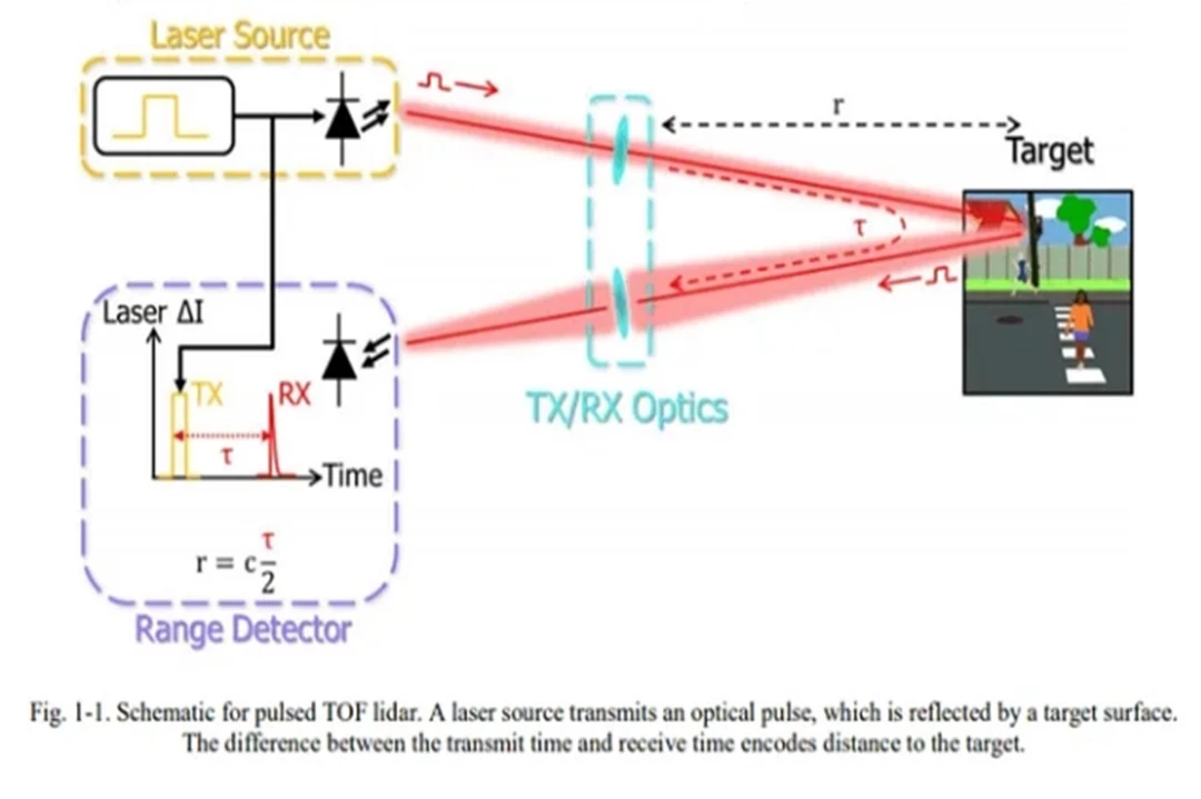
Time-of-Flight (ToF) LiDAR
ToF LiDAR operates based on the principle of measuring the time it takes for a laser pulse to travel to a target and back. This system emits short pulses of laser light and measures the time delay for the reflected light to return. The distance to the object is then calculated using the speed of light. One advantage of ToF LiDAR is its ability to provide accurate distance measurements with high resolution. However, it may face challenges in accurately measuring longer distances and suffers from potential interference issues.
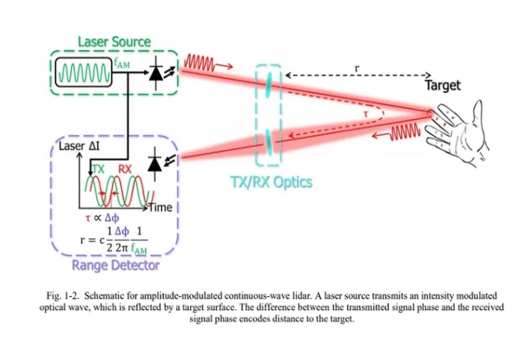
Amplitude Modulated Continuous Wave (AMCW) LiDAR
AMCW LiDAR, on the other hand, utilizes a continuous laser beam with its amplitude modulated at a known frequency. By analyzing the phase shift between the emitted and received signals, the system determines the distance to the target. AMCW LiDAR is known for its capability to measure both distance and velocity accurately. Its advantages include the ability to handle various environmental conditions, but it may have limitations in terms of resolution and susceptibility to interference.
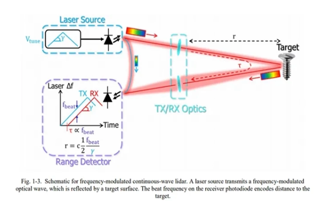
Frequency Modulated Continuous Wave (FMCW) LiDAR
FMCW LiDAR, in contrast, employs a continuous laser beam that is frequency modulated. The distance is calculated by analyzing the frequency difference between the emitted and received signals. FMCW LiDAR offers advantages such as high accuracy and the ability to measure multiple targets simultaneously. However, it may face challenges in terms of complexity and cost.
Smokeless Carbon Enhancer,Coal Carbonization,Petroleum Coke Carburizer,Graphitized Carburizer
Anyang Xinhai Metallurgical Refractory Co., Ltd , https://www.xinhaialloy.com